
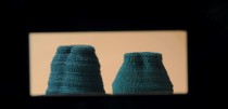
With modern mapping technology we can accurately create digital versions of our planet and with new machining technology we can then physically produce these forms with extreme accuracy. The physical data is taken from crater lakes bathymetry scan and this data is then imported into a 3-D programme to the create digital form. This form is then re-translated into the physical object.
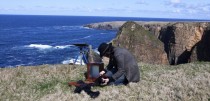
To start the process I searched various lake forms to see which have a bowl like shape so that I would not have to edit the from too much to make it fit for purpose. The best one I came across was also the best in terms of data available and the level of its geographical importance. Crater lake in the U.S state of Oregon has already had a great deal of geographical studies carried out on it and is also one of the best examples of bathymetry scan technology in America.


This data from the bathymetry scan was then turned into height fields in a 3D modelling program where the form could be used to digitally drape other surfaces over it to create a smoother, more abstract form.


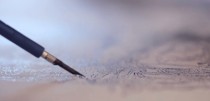
After the final form was created it was sent to a CNC machine to be milled out of MDF to create the mould for casting it in pewter.

The cast bowl was then filled down and polished.

Lacus will be shown at the Gin Palace ‘Details To Follow’ exhibition on the 9th – 11th of April on South Frederick Street 12-16, Glasgow.
For more info visit http://www.lacus.nckrss.com/ and http://theginpalacecollective.blogspot.com/


Comments